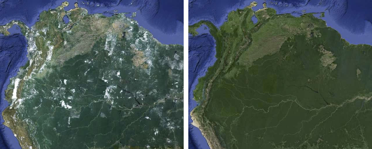
 Google has launched new satellite imagery for Google’s mapping products, removing the clouds digitally for better view.
How did Google manage to remove the clouds? Google’s satellite imagery is usually created like a quilt, the company stitches together imagery of different parts of the world. Using a process similar to how it produced the global time-lapse imagery of the Earth, Google says it took hundreds of terabytes of data from the USGS’s and NASA’s Landsat 7 satellite, and analyzed the photos to compute a clearer view.
The result is a single, 800,000 megapixel image of the world, which can be viewed in Earth and Maps when the user is zoomed out to a global view.
You can see the new satellite imagery by going to Google Maps and turning on satellite view, or by opening Google Earth, and zooming out. Read more about it in Google Maps blog here.
[Image courtesy: Google]

